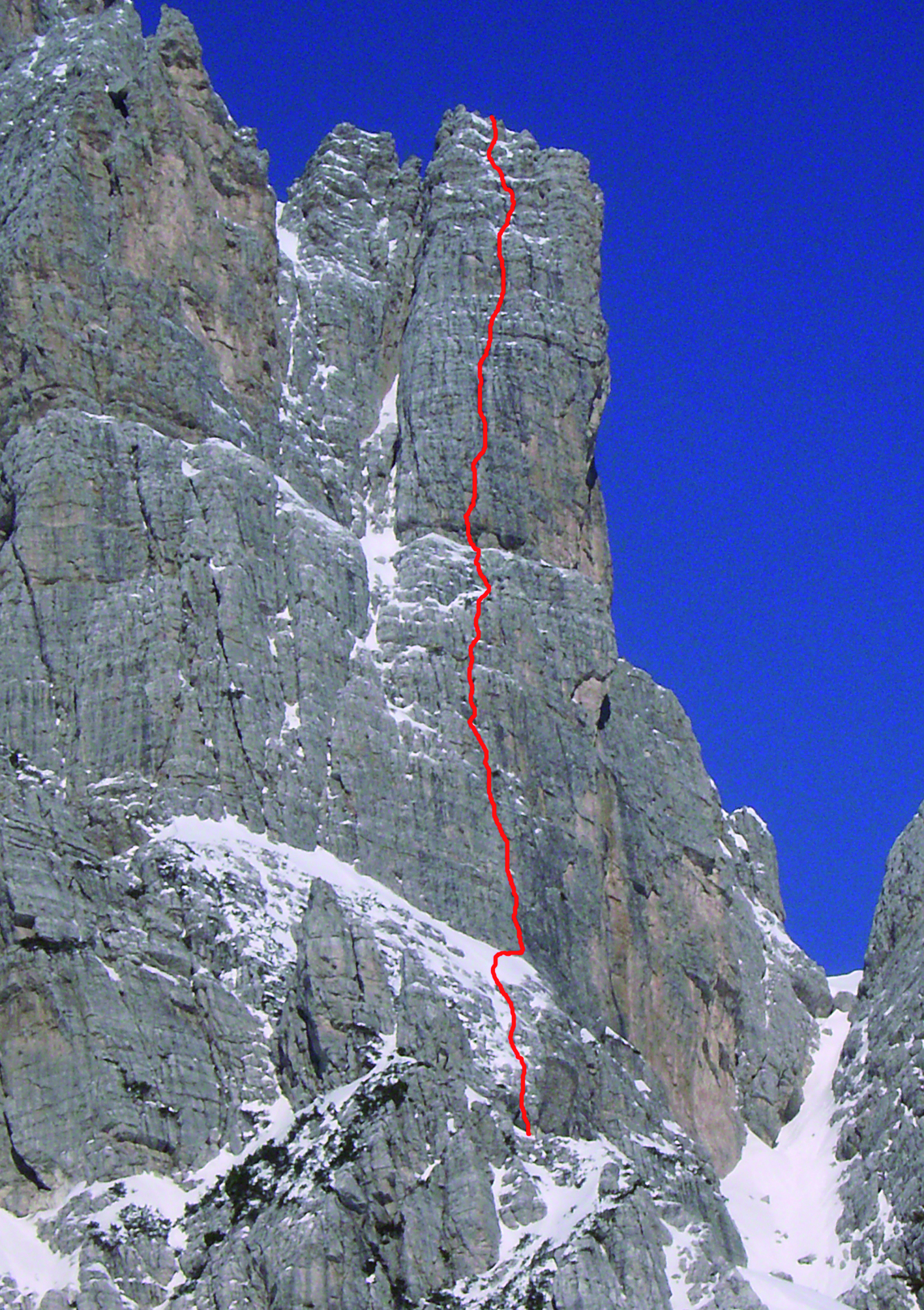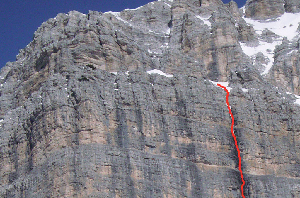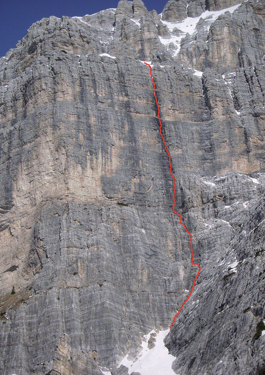
TORRE JOLANDA (2350 m)
South side – Via Super-Soro ****
FIRST CLIMBERS:
Soro Dorotei, 1984,
DEVELOPMENT:
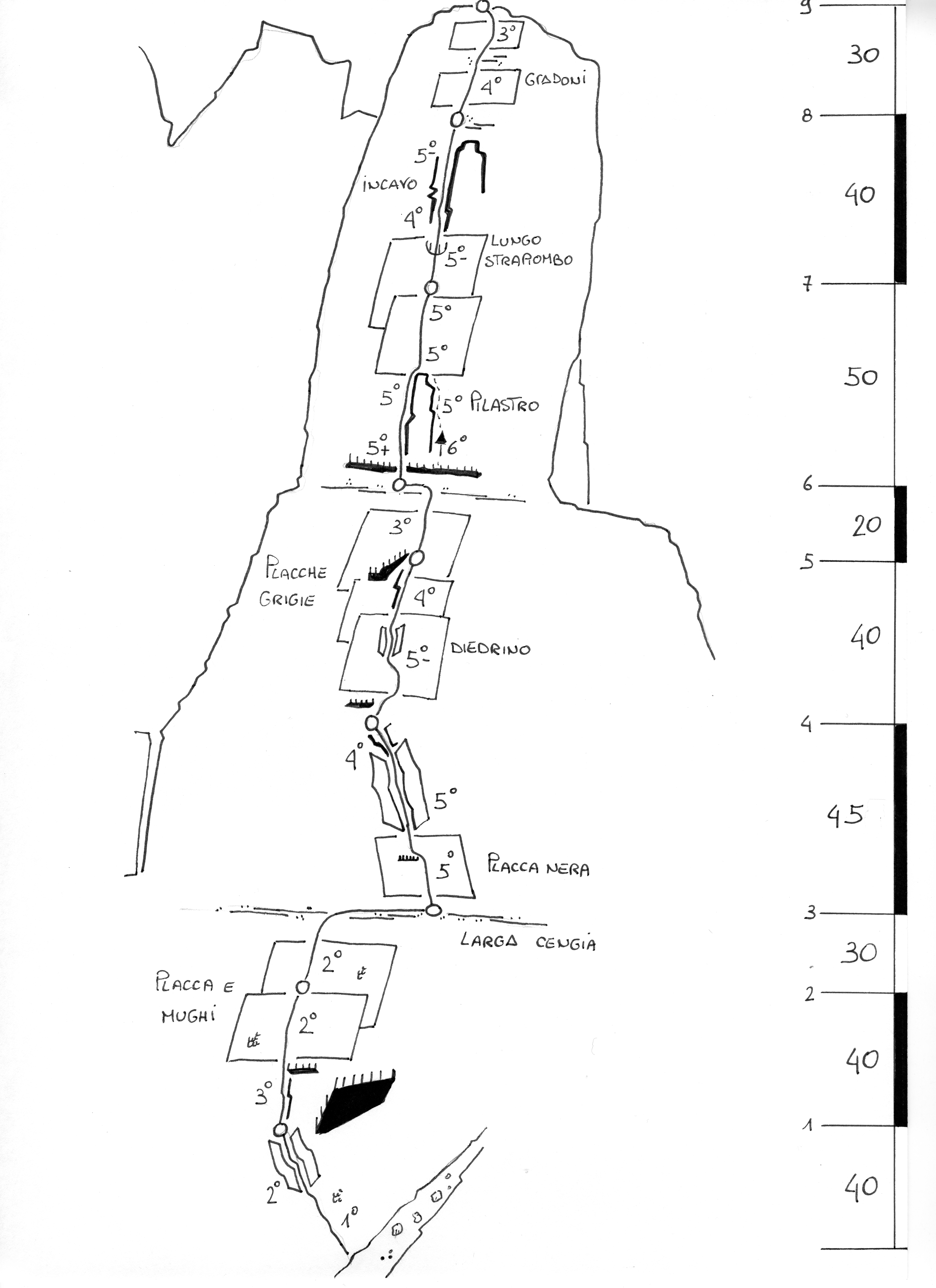
300 m (considering the base wall)
• DIFFICULTY: D+ R2; 5°
• ESTIMATED TIME: 3 ore
• EQUIPMENT:
standard equipment
IDEAL PERIOD:
may-october
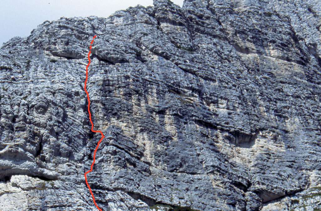
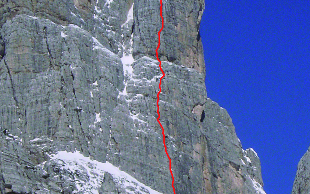
Very nice and straight itinerary that take place to the right of the via “Topo”, on an articulated and compact rock grey wall. In the last years it has been repeated many times and this made the climb almost completely bolted. The ascent, because of the nice climb and the good exposition, is very advisable. Be careful not to confuse the path with the modern climbs that, especially in the second half, are very close.
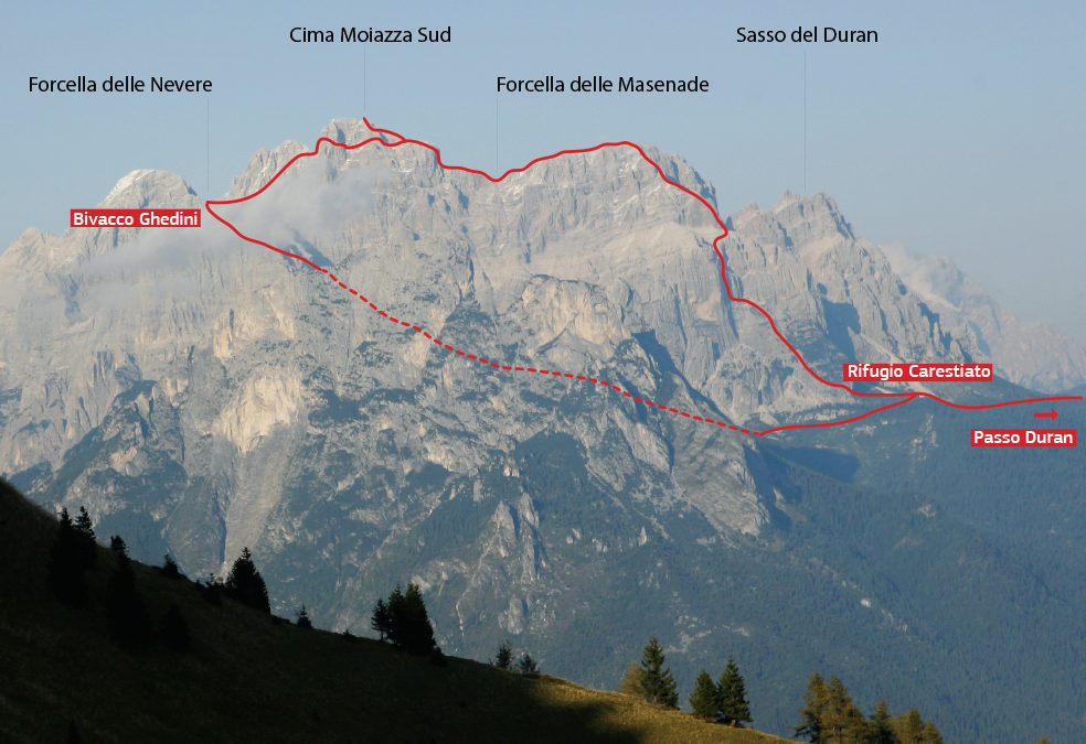
ACCESS
From Passo Duràn you follow the path that brings to Rifugio Carestiato, until you get to the motorable road. Few meters further it opens, towards north, a little valley with a clear track (the first part is often swampy). This path leads to Croda Spiza and it goes beyond it getting to a steep gravelly canyon (2° passage) that leads to the base of the rocks (1.10 h).
START POINT
You surpass the base wall (in common with the via “Topo”), then you cross the ledge on the right to a little grey dihedral.
DESCENT
From the top ot the tower you overpass a squeeze chimney getting to the great scree localized behind the top. You go down through it (there is a track) until it is possible to cross and go up again towards south reaching a pass between Torre Jolanda and a secondary forepart. From here, getting down through the clear gully under the wall (2°- passage) you gain the base of the rocks (1h).